 Everyday Bible Encouragement For Boys
 Bite Size Bible
 Bible Time Line Pamphlet
 DNA Of Relationships
 Premium Church Bible Large Print
 Resilient : Restoring Your Weary Soul In These Turbulent Times
 Filament Bible Journal 1 Corinthians
 Last Exchange : A Novel
 Tiny Testament Bible New Testament Comfort Print
 PIGMA Micron 01 Bible Study Pen
 Gone Dark
 Devocional De Esperanza Diaria - (Spanish)
 Dysfunctional Families : Making Peace With Your Past
 When The Day Comes
 Kids Bible
 When Is It Right To Die Pamphlet
 Fruit Of The Spirit Large Print Word Search (Large Type)
 Know Your Bible Better
 Genesis Time Line Pamphlet
 Where Is God In A World With So Much Evil
 When The Smoke Clears


Atlases Charts and Maps
Showing all 8 resultsSorted by latest
-
Sale!
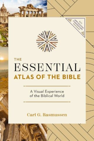
Essential Atlas Of The Bible
Original price was: $24.99.$14.97Current price is: $14.97.Embark on a fascinating journey through the lands where key biblical events unfolded. Visit the places where Jesus preached, Moses journeyed, and Paul spread the word of God – all from the comfort of your home with The Essential Atlas of the Bible.
With nearly 200 visually captivating, multidimensional maps and full-color images, this comprehensive atlas will deepen your understanding of biblical lands, history, and spirituality. Leveraging highly accurate mapping technologies, it provides an up-to-date geographical perspective that makes Scripture study both engaging and impactful.
Discover multifaceted insights through innovative chronological charts covering historical backgrounds, regions, weather, and roads of the Bible’s world. This full-color atlas is concise yet comprehensive – perfect for Bible scholars, future pilgrims to the Holy Land, or curious readers seeking greater insight into places frequently mentioned in the Old and New Testaments.
The Essential Atlas of the Bible goes beyond just providing information; it takes you on a pilgrimage across time, enriching every step of your Bible study journey where you will discover a visual experience of the biblical world.
Enhance your understanding and deepen your faith – don’t wait, grab your copy of The Essential Atlas of the Bible today.
Add to cart5 in stock
-
IVP Atlas Of Bible History Second Edition
$56.99Open Your Understanding of the World of Scripture
The story of the Bible is inextricably linked to the land. To understand biblical history, we need to understand how the people, events, and geography interacted to form that ancient world.
Spanning three thousand years of biblical history, The IVP Atlas of Bible History reveals the many fascinating ways that history and archaeology confirm and complement the Bible’s story. Taking a narrative approach, the atlas traces the unfolding of major events in the Old and New Testaments, from Abraham’s wanderings in Canaan and Egypt to Paul’s missions and the founding of new churches. It covers the many places of the world of the Bible, from Spain to Iran, from Yemen to Greece. Scholarly insights presented in a readable style add depth and color to our understanding of key people and stories in Scripture.
Features and benefits you’ll find in The IVP Atlas of Bible History:
*Ninety-seven maps to help understand the biblical narrative and provide background information
*More than 150 color photographs, panoramic illustrations, and site plans, plus a range of battle plans and small artworks
*Special features on subjects such as the peoples and languages of the Bible that will deepen understanding of geography, landscape, climate, culture, and religion.
This is the perfect companion for anyone seeking a clear, reader-friendly, visual introduction to the history of the Bible.
Add to cartin stock within 3-5 days of online purchase
-
Deluxe Then And Now Bible Maps (Expanded)
$24.99This is the paperback version of the best-selling Deluxe Then and Now Bible Maps! This book lets you see where Bible places are today. Full-color Bible maps are alongside locations of modern-day cities and countries.
Connect the Middle East of the news with the Holy Land in Scripture. Includes maps for favorite Bible stories, like Abraham’s journey to the promised land, the exodus out of Egypt, the story of Ruth, David’s rise from shepherd to king, and Paul’s missionary journeys.
32 maps, including:
*Journeys of Abraham, Jacob, Joseph
*The Exodus
*The 12 Tribes of Israel
*Kingdoms of Saul, David, Solomon
*Holy Land in the Time of Jesus
*Journeys of Paul, Peter, Philip
*Early ChristianityCharts, timelines, and illustrations, including:
*Old and New Testament Timelines
*Tabernacle and Temple
*Exodus Timeline
*Ark of the Covenant
*Where Jesus Walked
*The 12 Disciples
*City of Jerusalem
*Jesus’ Journey to the Cross
*Seven Churches of RevelationAn excellent way to make your Sunday school, homeschool, and Bible studies more interesting. This book uses larger, easier-to-read type than most Bible atlases.
Add to cart1 in stock
-
Charts Of Reformation And Enlightenment Church History
$29.99*Major Schisms in the First Sixteen Centuries
*Development of Church Government
*Orthodoxy and Unitarianism Compared
*Education in Puritan England
*Christianity and the American Revolution
*Origins of Presbyterians, Baptists, Methodists, and Lutherans
These are just a sample of the charts in this book, designed to provide a visual survey of a key part of our Christian heritage. Charts of Reformation and Enlightenment Church History covers the major events, movements, and people from the sixteenth century to the beginning of the nineteenth century. It includes charts of ideas and trends as well as pertinent diagrams.The book is divided into three primary sections:
* Early Modern Europe and the Reformation (1500 to 1650)
* The Rise of Religious Rationalism and the Enlightenment (1650 to 1750)
* The Period of British Settlement in North America: The Colonial Period of American Religious History (1600 to 1800)Within these sections, ninety charts are arranged under seventeen headings:
1. The Background of the Reformation
2. The Lutheran Reformation
3. The Calvinist Reformation
4. The Anabaptist Reformation
5. The English Reformation
6. The Roman Catholic Reformation
7. The Rise of Religious Rationalism
8. The Enlightenment
9. The Reaction against Creedalism and Rationalism: Pietism
10. Backgrounds of American Religious History
11. Congregationalists
12. Baptists
13. Presbyterians
14. Methodists
15. Other Groups
16. The Great Awakening
17. Religion and the American RevolutionAdd to cartin stock within 3-5 days of online purchase
-
Rose Book Of Bible Charts Maps And Time Lines
$34.99New! All Your Favorite Rose Charts in One Book!
ROSE BOOK OF BIBLE CHARTS, MAPS & TIME LINES
Now you can have 180 pages of full-color Bible charts, maps, and time lines in one spiral bound book. The full-color Rose Book of Bible Charts, Maps, and Time Lines contains–General Bible Charts
* 100 Well-Known People in the Bible
* 100 Well-Known Prayers in the Bible
* Table of Biblical Weights and Measures
* Books of the Bible
* Bible Overview–Old Testament
* Bible Overview–New Testament
* How We Got the Bible
* Christian History Time LineOld Testament Charts
* The Creation
* 100 Well-Known Old Testament Events
* Family Tree of Abraham, Isaac, and Jacob
* Names of God
* Jesus & The Names of God
* The Ten Commandments and You
* Feasts & Holidays of the Bible
* The Cycle Pattern in Judges
* Kings and Prophets
* Kings
* Prophets
* The Statue in the Book of Daniel
* Archaeology & the Bible–Old TestamentNew Testament Charts
* The Genealogy of Jesus Christ
* 100 Prophecies Fulfilled by Jesus
* Events in the Life of Jesus
* Miracles of Jesus
* Parables of Jesus
* The Beatitudes
* The Twelve Disciples
* Evidence for the Resurrection
* Biblical Descriptions of Heaven & Hell
* 100 Well-Known Events from Acts to Revelation
* 1 Corinthians 13
* The Armor of God
* The Fruit of the Spirit
* Acts of the Sinful Nature
* Seven Churches of Revelation
* Four Views of the End-Times
* Archaeology & the Bible–New TestamentMaps
* Middle East: The (BC) and Now
* Middle East: Expansion by Assyrian Rulers
* Middle East: Babylonian and Persian Empires
* Middle East: Fascination Facts and Figures
* Middle East and Central Asia
* The Holy Land: Then and Now
* The Holy Land: The Exodus
* Exodus Time Line
* The Holy Land: United Kingdom
* The Holy Land: Divided Kingdom
* Where Jesus Walked: Then and Now
* Paul’s Journey’s: Then and Now
* Paul’s First Journey
* Paul’s Second and Third Journeys
* Paul’s Journeys and GuideIllustrations and Diagrams
* Noah’s Ark
* The Tabernacle
* The Ark of the Covenant
* Solomon’s Temple
* Herod’s Temple
* Palm Sunday to EasterChristianity, Cults & Religions
* The Trinity
* Denominations Comparison
* Christianity, Cults & Religions
* Islam & ChristianityIndex
If you bought all of these charts and pamphlets separately, you would pay more than $250. Plus you can reproduce up to 300 copies of any chart free of charge (use in one church, not for sale
Add to cart1 in stock (additional units can be purchased)
-
Chronological And Background Charts Of The New Testament
$19.99This helpful volume helps the student of the New Testament organize and synthesize the vast amount of biblical and extrabiblical material involved by providing a helpful visual overview of the data, chronology, historical background, and criticism of the New Testament. This format allows facts, relationships, parallels, and contrasts to be grasped quickly and easily.
Add to cartin stock within 3-5 days of online purchase
-
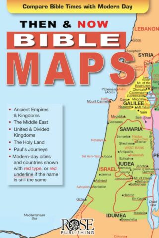
Then And Now Bible Maps Pamphlet
$4.99Where are Bible Lands today? This handy quick reference fold-out shows you! It contains more than a dozen Bible maps that include the modern-day boundaries in red. Fantastic for comparing places in the news with places in the Bible.
Includes the following maps:
*The Middle East during Old Testament Times
*The Assyrian Empire, Babylonian Kingdoms and Persian Empire
*The Holy Land during the time of the Old Testament
*United Kingdom, Divided Kingdom compared with modern-day Israel and surrounding countries
*The Holy Land during the time of JesusAll of Paul’s Journeys (Roman Empire at AD 60)
Fits in the back of most Bibles. Size: 8.5″ x 5.5″ Unfolds 38 inches.
Add to cart2 in stock